Precision geospatial data for construction & engineering projects
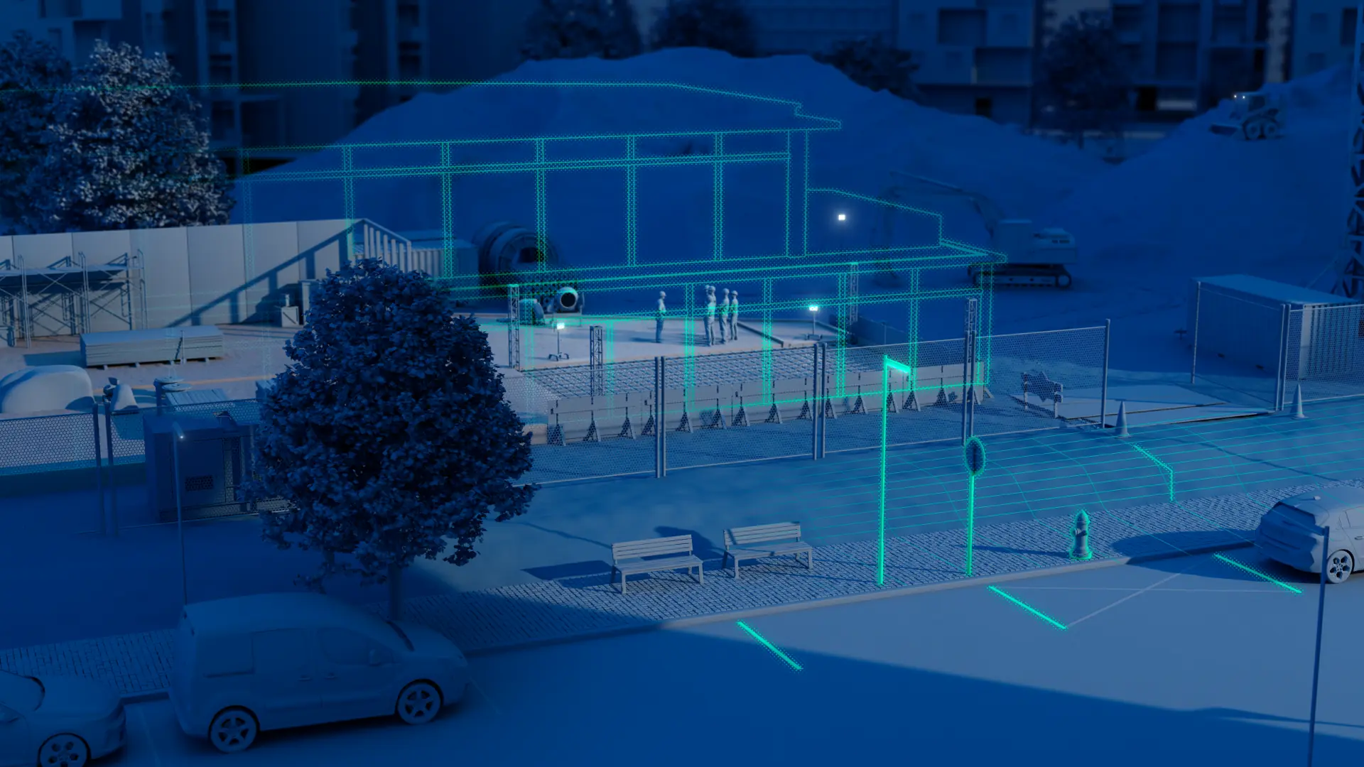
Cyclomedia transforms real-world construction sites into measurable, data-rich digital spaces, enabling engineering and construction teams to plan, validate, and execute projects with fewer site visits, lower costs, and reduced risks. Perform remote site inspections, improve design accuracy, and reduce costly fieldwork with high-resolution 360° imagery and LiDAR.

Construction projects require accurate, real-world site data
Construction and engineering teams work to tight programmes, rising complexity, safety obligations, and strict cost control. Without accurate, current site data integrated into existing design and planning workflows, assumptions increase, site visits multiply, and project risks increase.

Outdated site data increases design uncertainty and costly rework
Field surveys slow timelines and expose crews to safety risks
Limited visibility into site constraints reduces planning accuracy
Conflicting datasets create coordination challenges across stakeholders
Turn real-world site data into construction intelligence
Cyclomedia delivers high-resolution 360° imagery, LiDAR, and AI-powered feature extraction to provide a unified, accurate view of construction sites. Reduce field visits, improve planning accuracy, and streamline construction execution with measurable geospatial data.
Cyclomedia supports construction and engineering teams across planning, execution, and verification with accurate, measurable site intelligence.
Design and pre-construction:
Access precise 3D context to validate designs, assess constraints, and identify conflicts before construction begins.
Project planning:
Evaluate terrain, utilities, access, and construction impact before mobilization to reduce delays and unexpected site conditions.
Risk and safety analysis:
Evaluate hazards, line of sight, access routes, and staging areas to support safer construction planning.
Bid & cost estimation:
Strengthen bids with defensible site data, improving cost accuracy and reducing risk in materials, labor, and site conditions.
Construction monitoring:
Track construction progress, validate work, and compare site conditions over time using repeatable, measurable imagery and LiDAR.
Accurate, defensible geospatial data
Accurate, defensible geospatial data supports construction and engineering teams throughout the full project lifecycle—from early planning and design through execution and validation.
Reduce rework and project risk
High-precision site data reduces design conflicts, improves accuracy, and minimizes costly rework.
Improve efficiency and site safety
Remote site understanding reduces field visits, shortens planning cycles, and lowers exposure to hazardous environments.
Strengthen collaboration and transparency
A shared, measurable digital view of the site keeps engineers, contractors, and owners aligned from design through construction.
Support digital twin and BIM workflows
Reliable, up‑to‑date data improves design certainty and reduces downstream construction risk.
Support verification and compliance
Measurable site data enables defensible verification, documentation, and audit readiness.