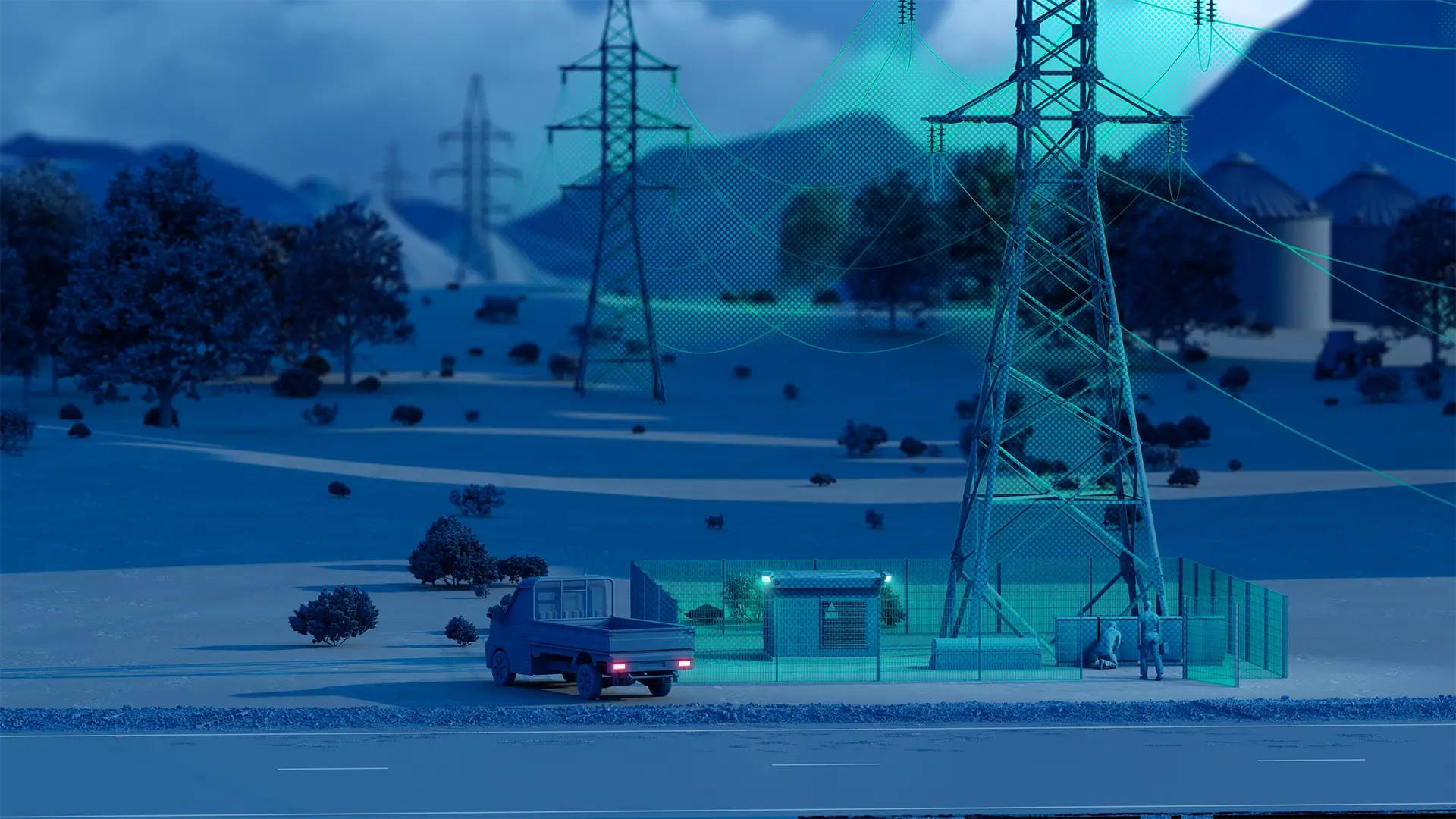
Precision insights for smarter utility and energy operations
Cyclomedia captures vast utility networks in high-resolution imagery and LiDAR, including transformers, poles, lines, and ROW environments, turning them into measurable digital assets that support safer operations, efficient planning, and proactive risk management across your entire service territory.

Aging networks need accurate, up-to-date asset insights
Electric, gas, water, and broadband utilities manage thousands of distributed assets across large, complex territories. Without precise, current geospatial insights, inspections slow down, vegetation risks escalate, and expansion projects face avoidable cost and safety pressures.

Manual field surveys increase operational cost and safety exposure
Vegetation risks are hard to track without consistent visual insights
Incomplete or outdated asset records hinder maintenance and planning accuracy
Outage prevention requires objective, measurable system visibility
Turning distributed infrastructure into measurable digital reality
Cyclomedia delivers high-resolution 360° imagery, LiDAR, and AI-driven extraction that provide utilities with precise, consistent data on every asset, reducing field time, improving safety, and supporting long-term network reliability, growth, and operational resilience.
Asset inventory & mapping:
Create complete, GIS-ready inventories of poles, equipment, valves, meters, and roadside assets at scale, with easy integration into utility data management systems.
Vegetation management:
Identify encroachments and high-risk areas using accurate visual and LiDAR-based context to support proactive mitigation.
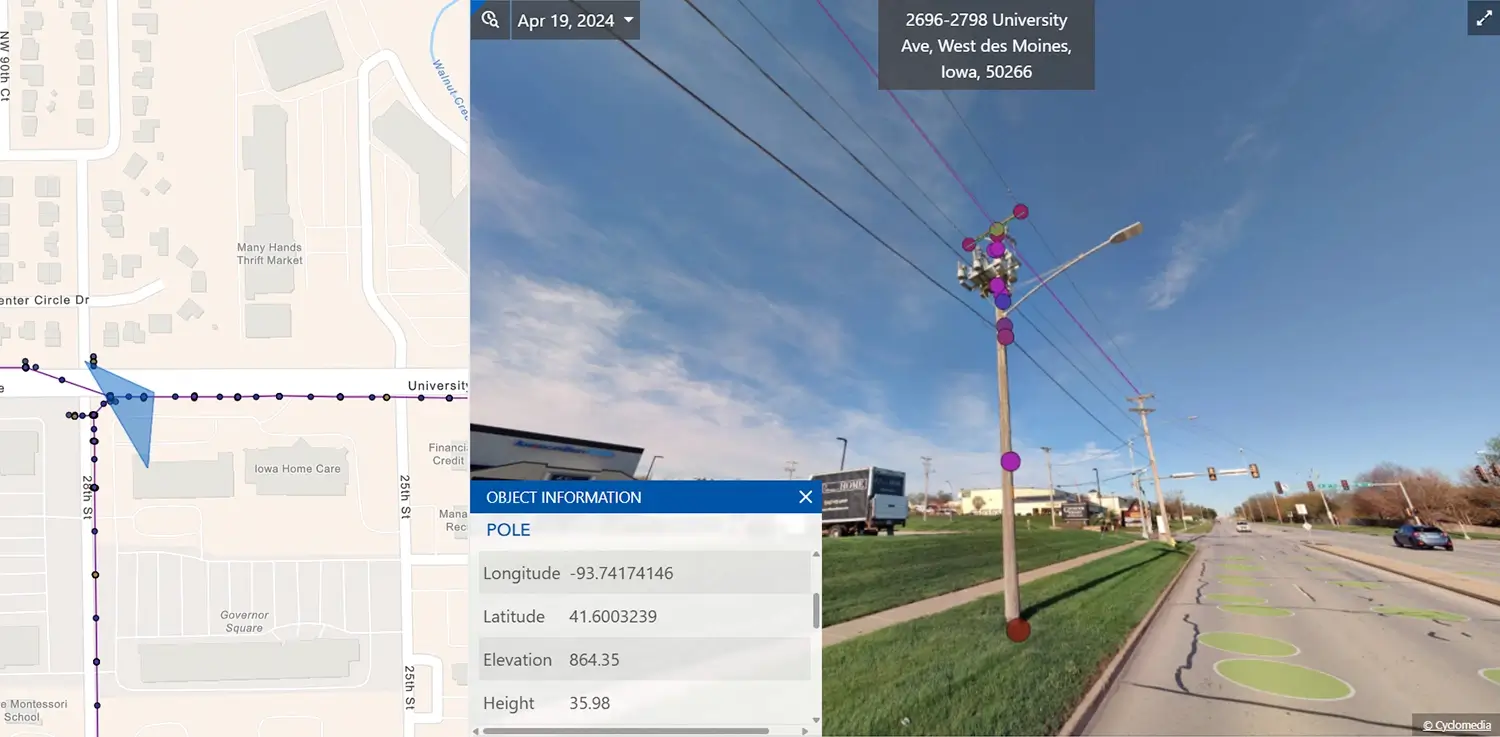
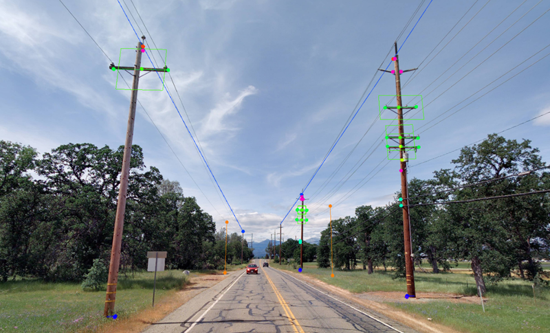
Pole & attachment analysis:
Measure pole height, span, clearances, and attachments remotely to support compliance, permitting, and joint-use reviews.
Network planning & expansion:
Assess routes, constraints, and construction impacts with measurable imagery and LiDAR for confident planning.
Outage & risk assessment:
Use timestamped visual context to investigate outages, validate conditions, and support rapid restoration planning and safer field preparation.
Accurate insights for utility workflows
Utilities rely on accurate, measurable asset insights to reduce operational risk, improve efficiency, and make defensible decisions. Cyclomedia provides consistent data that supports planning, compliance, safety, and long-term operations across teams and systems.
Reduce field time and operational cost
Remote visibility replaces many physical inspections, improving efficiency while lowering truck rolls and labor exposure.
Enhance safety and compliance
Accurate, up-to-date asset and ROW data supports regulatory reporting, reduces risk, and strengthens safety programs.
Support reliable, scalable network planning
High-precision imagery and LiDAR give engineers confidence in decisions related to upgrades, expansions, and resilience.
Improve asset data completeness
Consistent capture reduces data gaps and supports cross-checking records across utility systems and teams.
Support joint-use decisions
Measured asset and clearance context supports joint-use reviews and defensible operational documentation.