Precision insights for safer, smarter transportation networks
Cyclomedia transforms roadway systems into precise, data-rich environments, empowering DOTs with accurate, consistent, and defensible intelligence for planning, safety, pavement, and asset management.

Aging networks demand defensible ground truth
DOTs and transportation agencies must maintain vast networks, improve safety, and plan long-term mobility while managing limited budgets and rising expectations. Without current, precise roadway data, planning becomes reactive, costly, and harder to justify.

Limited visibility into roadway conditions slows planning and safety work
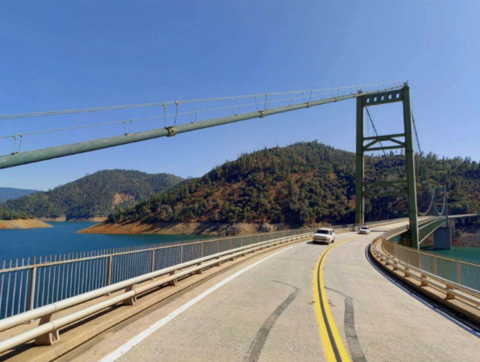
Traditional field surveys are expensive, slow, and expose crews to risk
Disparate datasets hinder cross-agency coordination and consistency
Unverified data weakens funding requests and project justification
Turning road networks into measurable, actionable intelligence
Cyclomedia delivers high-resolution 360° imagery, 3D LiDAR, and feature-rich asset inventories aligned to customers’ LRS to support DOT planning, highway safety, pavement, and asset management workflows with accurate, consistent, defensible roadway insights.
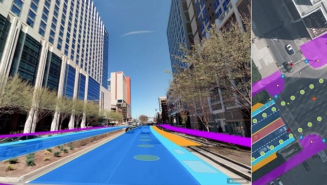
LRS-aligned data delivery:
Receive roadway assets and measurements aligned to your Linear Referencing System for enterprise use.
Safety & risk assessment:
Evaluate hazards, visibility limits, and roadway risks through accurate real-world measurements.
Asset inventory & compliance:
Build complete, GIS-ready inventories of signs, signals, safety features, guardrails, and roadside assets.
Construction & maintenance:
Use measurable context to plan work zones, assess conflicts, and reduce costly field-based surprises.
Roadway condition analysis:
Identify pavement conditions, defects, and surface issues with measurable imagery and LiDAR.
Reliable, measurable data for transportation teams
Reliable, measurable roadway data supports DOT planning, highway safety, pavement, and asset management. LRS-aligned inventories and precise measurements strengthen roadway inventories, support HPMS and MIRE reporting, and reduce reliance on costly field surveys.
Defensible, high-accuracy Insights
360° imagery and LiDAR provide precise, repeatable measurements for funding requests, planning, and audits.
Faster and safer decision-making
Remote evaluation reduces site visits, accelerates analysis, and limits exposure to roadway hazards.
Improved network safety and performance
Accurate visibility into roadway conditions and safety assets supports proactive maintenance and investment.
HPMS and MIRE Readiness
Support HPMS and MIRE reporting with consistent roadway inventories and measurements aligned to your LRS.
ADA and compliance support
Provide consistent roadway and streetscape evidence to support ADA compliance checks and audit-ready documentation.