Accelerate fiber & 5G rollout with street-level insights
Cyclomedia gives CSP teams measurable 360-degree imagery, LiDAR, and asset insights so they can assess streets, poles, facades, and access conditions remotely, reducing site visits and accelerating fiber and 5G rollout.

Network rollouts are moving faster than field data can keep up
CSPs are under pressure to expand fiber coverage and densify 5G while controlling costs and regulatory demands. Yet planning, permitting, and delivery teams still rely on fragmented, outdated, or incomplete field data.

Repeated site visits increase cost, delay civil works, and impact resources
Outdated or incomplete maps slow fiber design and 5G site selection
Poor visibility of poles, facades, and street furniture adds risk
Insufficient real world context makes permits, wayleaves, and funding harder
One measurable view for planning, build, and operations
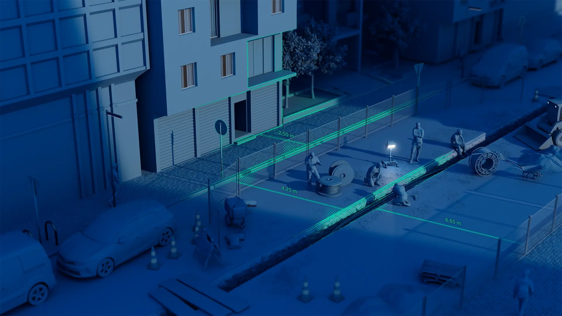
Cyclomedia provides highprecision 360° imagery, LiDAR, and derived asset data that give CSPs a single, measurable view of streets, structures, and infrastructure, supporting planning, design, deployment, and operations.
Fibre network planning:
Design routes with clear visibility of streets, surfaces, ducts, and aerial infrastructure before crews go to site.
Field operations & assurance:
Equip teams with accurate street level context to reduce site revisits and improve build and audit quality.
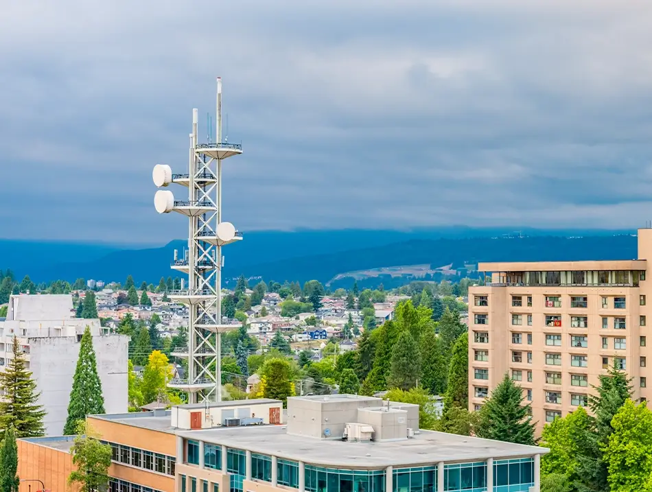
5G and small cell planning:
Assess poles, facades, power access, and line-of-sight remotely to speed site selection and permitting.
Broadband expansion & funding:
Support business cases and subsidy bids with defensible evidence of coverage gaps and deployment feasibility.
Pole & street furniture audits:
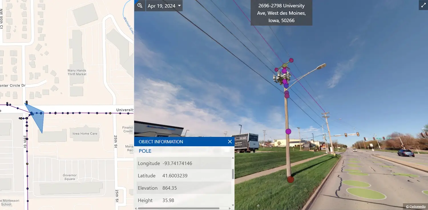
Check clearances, attachments, spans, and loading conditions with measurable imagery and LiDAR.
Real world telecom insights for better network decisions
Our comprehensive platform combines cutting-edge capture technology, cloud-based visualization tools, and advanced machine learning to deliver unprecedented insights into urban infrastructure, enabling more efficient asset management, planning, and operations across diverse industries worldwide.
Faster planning, permitting, and build
Teams move from feasibility to detailed design faster, with fewer site visits required and quicker coordination across partners.
Lower operational cost and deployment risk
Better field context helps CSPs avoid surprises, reduce redesign, and improve productivity across multi-contractor programs.
Improved cross‑team and partner alignment
A single, shared view of poles, streets, and rights of way ensures planners, engineers, contractors, and partners work from the same accurate, up‑to‑date information.
Reduced risk in permitting and construction
Clear visibility into assets, clearances, and surroundings helps prevent permitting issues, construction conflicts, and costly rework before crews enter the field.
Defensible, Measurable Ground Truth
Accurate 360° imagery and LiDAR reduce uncertainty and enable confident engineering decisions backed by verifiable data.