Heading 1
Heading 2
Heading 3
Heading 4
Heading 5
Heading 6
Lorem ipsum dolor sit amet, consectetur adipiscing elit, sed do eiusmod tempor incididunt ut labore et dolore magna aliqua. Ut enim ad minim veniam, quis nostrud exercitation ullamco laboris nisi ut aliquip ex ea commodo consequat. Duis aute irure dolor in reprehenderit in voluptate velit esse cillum dolore eu fugiat nulla pariatur.
Block quote
Ordered list
- Item 1
- Item 2
- Item 3
Unordered list
- Item A
- Item B
- Item C
Bold text
Emphasis
Superscript
Subscript
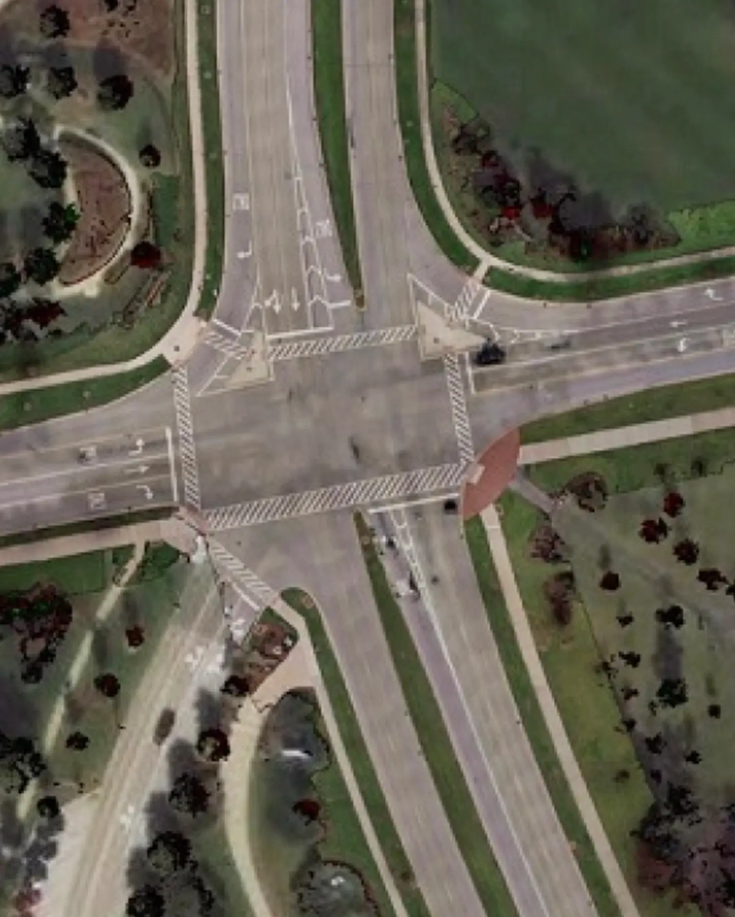
High detailed true ortho photo of the road and its direct surroundings
The street ortho is derived and generated from Cyclomedia’s HD Cycloramas and LiDAR point clouds, at street level without the obstruction of trees, flyovers or moving vehicles that block the view.

Street Ortho: High-detail orthographic road imaging from LiDAR and Cycloramas
Street ortho is a high detailed true ortho photo of the road and its direct surroundings, without any obstruction from trees, bridges, overpasses or moving objects. Street Ortho gets generated out of our LiDAR Point Clouds and Cycloramas, both synchronically collected by our mobile mapping system. By combining them, we create a true ortho photo from the ground up.
Cyclomedia’s Street Ortho quickly translates reality into a digital visualization by providing an orthographic, top down view of the road and its immediate surroundings. It removes perspective distortion and visual occlusion, enabling accurate surface level analysis that integrates seamlessly with GIS and asset management workflows. Whether your goal is analyzing the road network, mapping out entire areas or updating map data of smaller areas within, Street Ortho enables performing the task with high precision.
Street ortho enables faster and more consistent decisions
Street Ortho provides a uniform, orthographic view of road surfaces that supports objective evaluation across entire networks. This consistency allows teams to compare conditions, prioritize maintenance, and justify decisions using the same reliable data foundation.
Reduce dependency on on site inspections
By making surface conditions clearly visible and measurable from the desktop, Street Ortho reduces the need for repeated field visits. This saves time, lowers operational costs, and minimizes disruption to public space.
Improve asset inventories and surface classification
Street Ortho supports the identification and classification of pavements, markings, and related infrastructure. This improves the completeness and accuracy of asset registers while enabling more efficient updates over time.
Support GIS driven planning and analysis
As a GIS compatible dataset, Street Ortho integrates easily into existing spatial workflows. It enables planners and analysts to work with surface accurate information alongside other geospatial layers.
Create transparency for policy and public communication
A clear, orthographic representation of public space helps organizations explain decisions, support compliance, and communicate conditions with internal stakeholders and the public using shared, visual evidence.
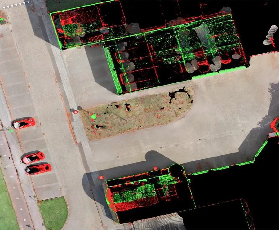
Precise object detection
The detail of the ortho photos is high enough to clearly identify objects, even in shaded areas. By splitting up the point cloud as height layers, the height of objects is also separately displayed. This enables you, for example, to identify the real facade outline besides to only using the roof outlines based on aerial imagery.