Heading 1
Heading 2
Heading 3
Heading 4
Heading 5
Heading 6
Lorem ipsum dolor sit amet, consectetur adipiscing elit, sed do eiusmod tempor incididunt ut labore et dolore magna aliqua. Ut enim ad minim veniam, quis nostrud exercitation ullamco laboris nisi ut aliquip ex ea commodo consequat. Duis aute irure dolor in reprehenderit in voluptate velit esse cillum dolore eu fugiat nulla pariatur.
Block quote
Ordered list
- Item 1
- Item 2
- Item 3
Unordered list
- Item A
- Item B
- Item C
Bold text
Emphasis
Superscript
Subscript
High accuracy three dimensional point cloud data for reliable spatial analysis
Governments and infrastructure owners must understand the physical world in three dimensions to plan, assess, and manage public space effectively. From network design to safety and compliance, decisions increasingly depend on accurate spatial data that reflects real world conditions rather than assumptions or incomplete observations.

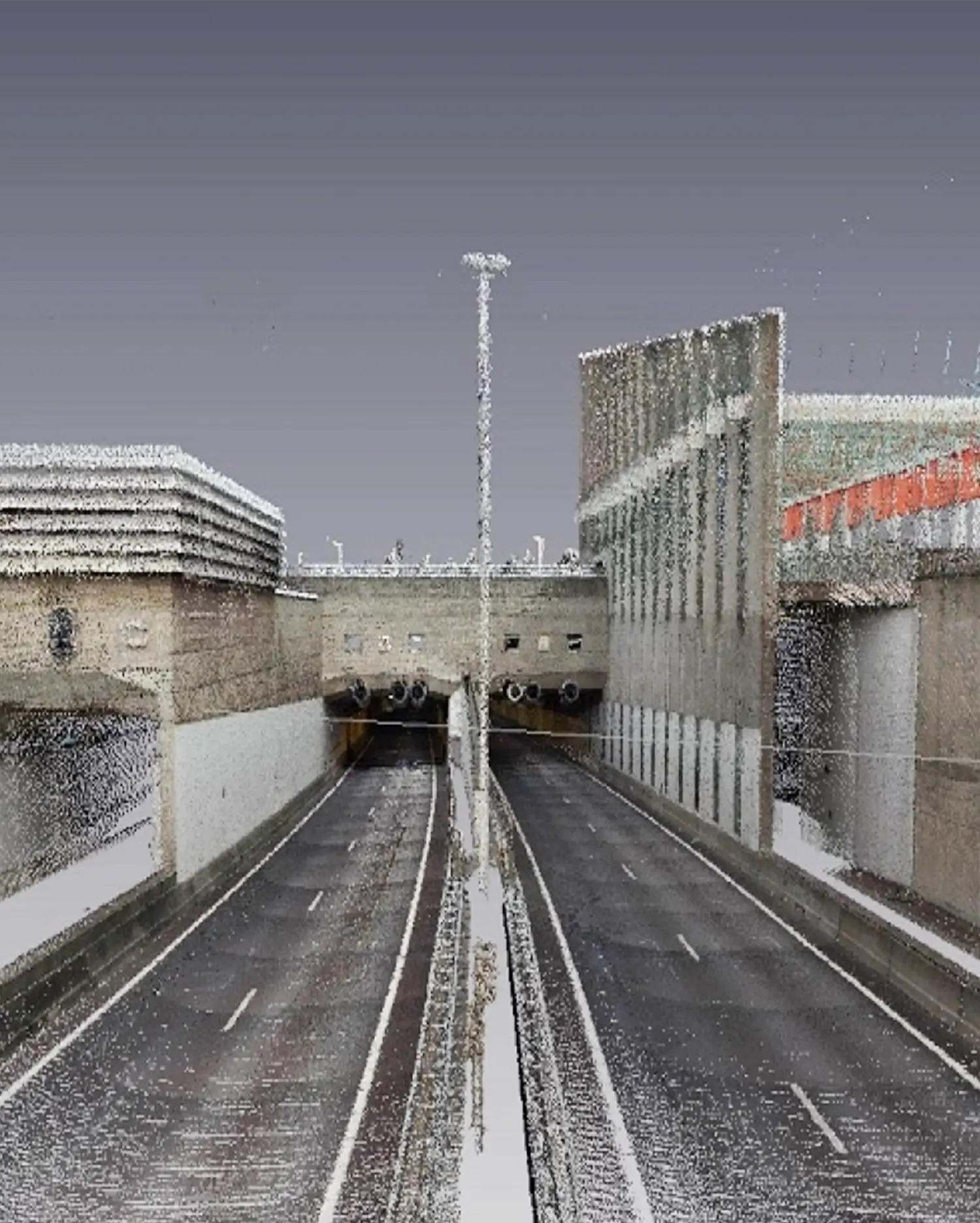


The LiDAR point cloud from Cyclomedia is a three-dimensional point cloud with a very high density.
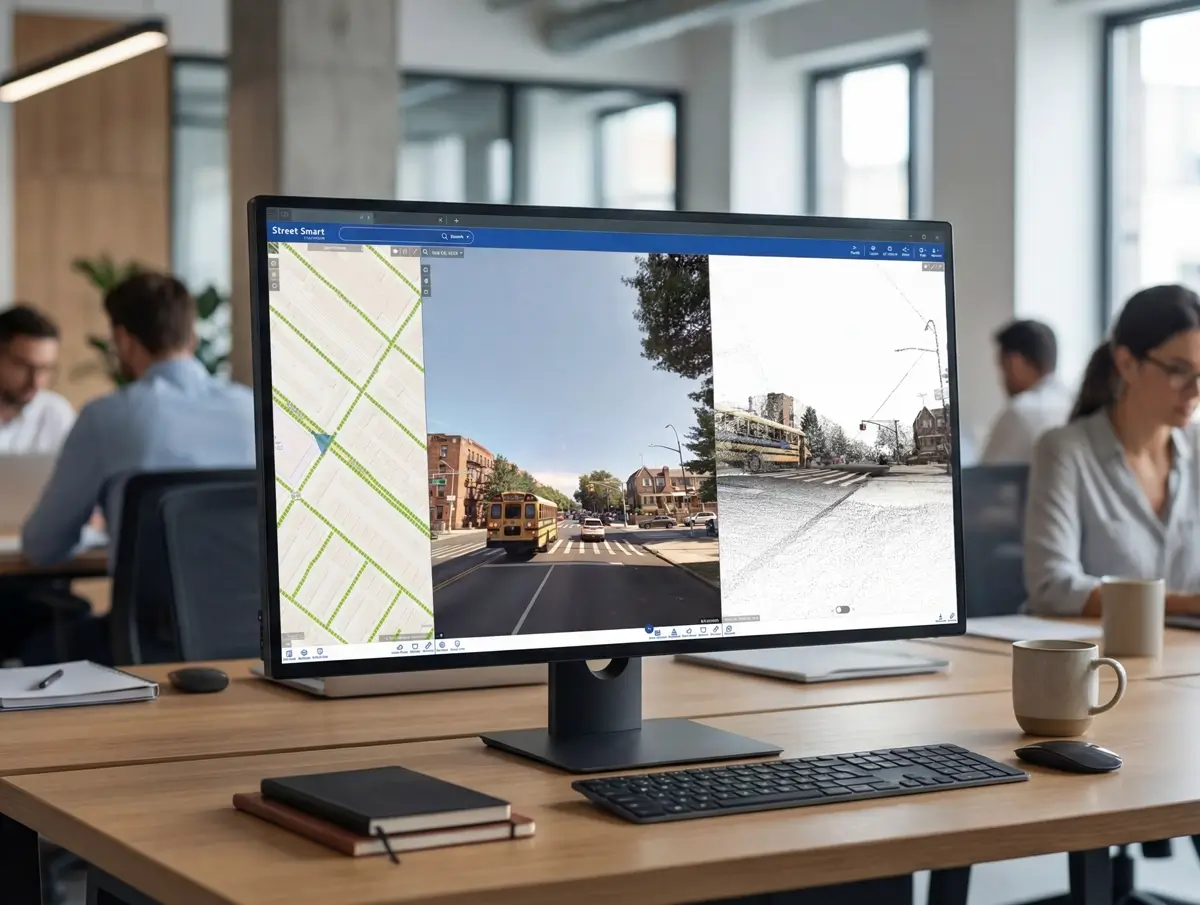
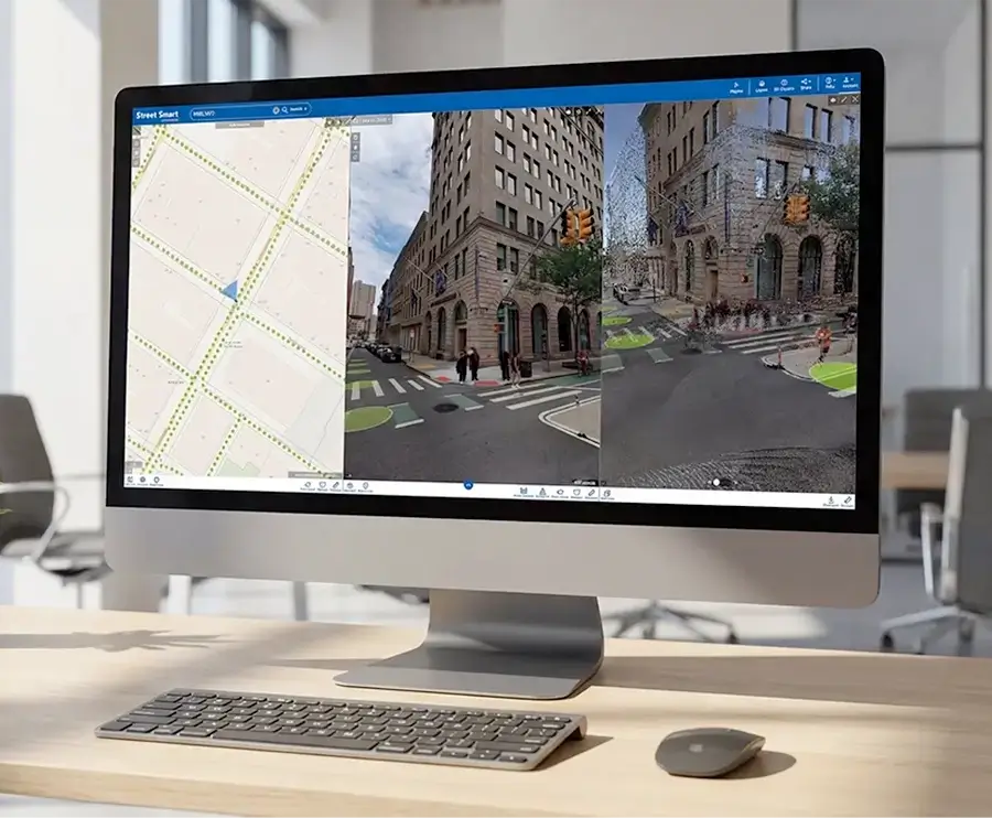
With decades of innovation in street level imagery and LiDAR data capture, Cyclomedia provides public organizations and infrastructure professionals with a dependable digital representation of the outdoor environment. By capturing imagery and geometry together, teams can work with data that supports confident measurement, analysis, and planning across large areas.
LiDAR plays a central role in this approach by delivering precise three dimensional point cloud data with reliable XYZ positioning. When combined with street level imagery, it creates a spatially accurate foundation that can be reused across inspection, engineering, and planning workflows.
Accurate 3D insights with LiDAR data
LiDAR transforms captured geometry into a consistent and reusable three dimensional dataset. It enables accurate measurements, strengthens spatial analysis, and supports informed planning decisions while reducing the need for repeated site visits and manual data collection.
Enable accurate height, clearance, and distance measurements
LiDAR provides precise three dimensional point cloud data that allows teams to measure heights, clearances, and distances with confidence. This supports safety assessments, engineering checks, and compliance tasks without returning to site.
Support engineering and infrastructure planning workflows
Engineers and planners use LiDAR data to analyze spatial constraints, design networks, and assess feasibility. The reliable geometric foundation helps teams make informed decisions earlier in the planning process.
Strengthen spatial analysis with reliable geometry
By adding accurate three dimensional geometry to visual data, LiDAR improves the quality of spatial analysis. It allows organizations to understand relationships between assets, terrain, and structures more clearly.
Public space management and asset management
Its high accuracy and photorealistic character makes the Cyclomedia LiDAR Point Cloud very suitable for performing tasks in public space management. Whether it concerns vegetation analysis, inventory of objects (road markings, traffic signs, street furniture) or flooding and drainage simulations, the point cloud is a very valuable data source.
Real estate and valuations
Based on the Cyclomedia LiDAR Point Cloud it is very easy to construct the contours of existing buildings in 3D. This makes it possible to efficiently determine the volume of real estate objects to support the valuation process.