Cyclomedia provides accurate geospatial data and intelligence that help organisations understand public space. By combining detailed street‑level imagery, precise location data, and integrated insights, teams can evaluate assets remotely, review conditions with confidence, and support planning without repeated field visits. Our products work together to provide a consistent, reliable picture of what exists in the real world.
Captured data
High‑accuracy street‑level imagery (Cyclorama's), LiDAR point clouds, and aerial data create a consistent and measurable digital representation of public space. These datasets form the foundation for inspection, measurement, comparison over time, and large‑scale analysis withoutrepeated site visits.
Assets
By combining high-resolution street-level imagery, LiDAR and other sensor data with advanced AI and machine learning models, Cyclomedia automatically extracts, classifies and analyzes real-world features at scale. This results in objective, repeatable insights that can be directly used across departments.

Street Smart
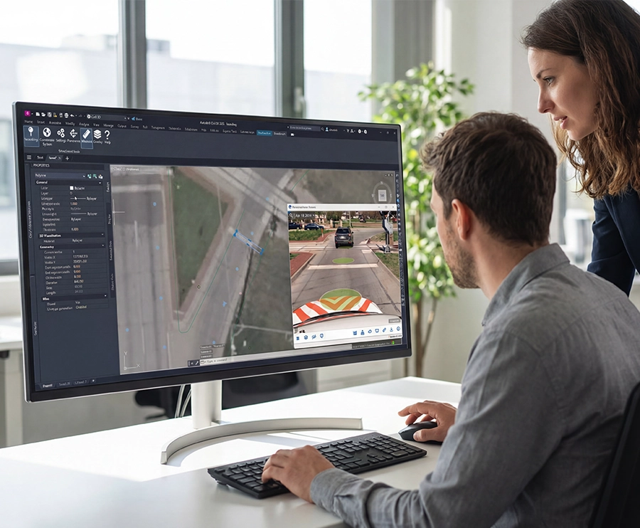
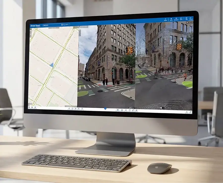
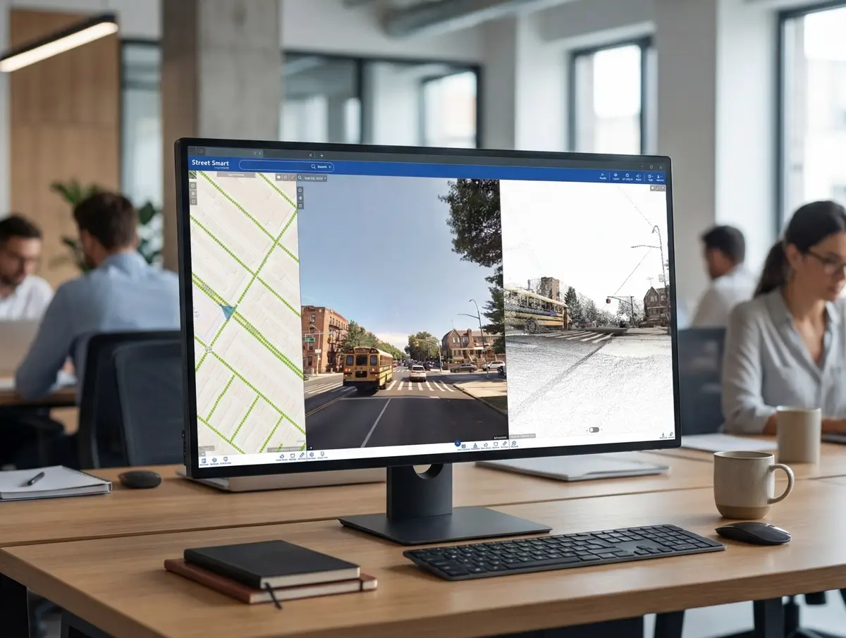
Street Smart is the central environment for viewing, measuring, and comparing geospatial data. It enables professionals to inspect assets, validate conditions, and analyse change directly from their desktop using reliable visual and spatial context.
Integrations & APIs
Open integrations and APIs connect Cyclomedia data with existing GIS, asset management, and enterprise systems. This ensures accurate and consistent information flows across tools, teams, and workflows.