Reliable insights to support safer road networks
Use accurate 360° Street-Level Imagery, LiDAR Data, and Geospatial Data to assess road conditions, review safety infrastructure, and identify risk factors—supporting evidence-based road safety planning without relying solely on field surveys.


A clear, consistent view of road safety conditions
Improving road safety requires insights into road layout, signage, markings, and roadside features across the entire network. Cyclomedia provides verified street-level imagery and LiDAR Data that enable authorities to assess safety conditions remotely, maintain consistent records, and support targeted safety interventions with confidence.

From reactive analysis to proactive road safety management
Traditional road safety analysis often depends on periodic inspections and incident data alone. By combining visual and spatial data in one environment, Cyclomedia helps road authorities identify risk patterns earlier, prioritise improvements, and maintain a structured, evidence-based approach to safety planning.
How Cyclomedia supports road safety projects
Cyclomedia supports road safety management across urban and rural networks. Each use case combines visual context and spatial data to help organisations assess risk, review infrastructure, and support informed safety decisions.
Road network risk assessment
Assess road layout, geometry, and roadside features to identify risk factors and prioritise safety improvements.

Traffic signs and markings review
Review the presence and condition of signs and pavement markings to support maintenance and improve road user guidance.
Junction and corridor safety analysis
Analyse junctions and corridors to assess visibility, layout, and interaction risks for different road users.
Solutions that strengthen road safety decisions
Combine 360° Street-Level Imagery, LiDAR Data, and platform tools to build a reliable foundation for road safety assessment, planning, and monitoring.
360° Street-level imagery
Review road environments remotely to assess layout, signage, markings, and roadside features.
LiDAR data
Use 3D spatial data to analyse road geometry, clearances, and spatial relationships affecting safety.
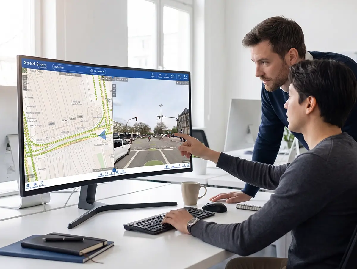
Cyclomedia Street Smart platform
Central environment for analysing imagery, measuring features, and documenting road safety insights.
Road geometry analysis
Assess curves, gradients, and alignment to identify potential safety risks.
Safety asset inventory
Maintain a structured inventory of traffic signs, markings, and roadside safety assets.
Measurement tools
Measure widths, distances, and clearances directly within imagery and LiDAR Data.
GIS integrations
Integrate road safety insights into existing GIS workflows and safety programs.
Digital twin infrastructure
Support safety scenario analysis using realistic digital representations of road networks.
Infrastructure intelligence
Combine visual and spatial data to support informed, defensible road safety decisions.