Reliable insight into every asset you manage
Transform how you manage infrastructure assets with automated detection, condition monitoring, and comprehensive lifecycle tracking powered by geospatial intelligence.


From field-heavy workflows to data-driven operations
Asset teams often lack consistent, up-to-date information. Cyclomedia centralizes visual data, measurements, and asset attributes so departments work from the same verified source of truth. This reduces operational risk, streamlines inspections, and supports compliance across asset programs.

From fragmented records to shared asset intelligence
Asset data is often incomplete, outdated, or stored across multiple systems. By combining Geospatial Data with visual evidence, Cyclomedia enables organisations to validate asset records, detect changes over time, and reduce uncertainty in inspections, compliance, and long-term planning.
How Cyclomedia supports asset management workflows
Cyclomedia supports asset management across public space and infrastructure domains. Each use case combines visual data, measurement tools, and integrations that help teams work more efficiently and make informed decisions with confidence.

Public space asset inventory
Identify and verify street furniture, signage, road features, and lighting using street-level imagery and LiDAR Data.
Infrastructure and utility assets
Assess poles, cabinets, and related assets with visual context to support inspections, maintenance planning, and coordination.

Change detection and monitoring
Compare historical imagery to detect asset changes, support updates, and maintain accurate records over time.
Solutions that strengthen asset management decisions
Combine imagery, LiDAR Data, and platform tools to create a reliable foundation for inspections, asset records, and long-term planning.
360° Street-level imagery
View assets at street level to support inventory, inspection, and documentation tasks.
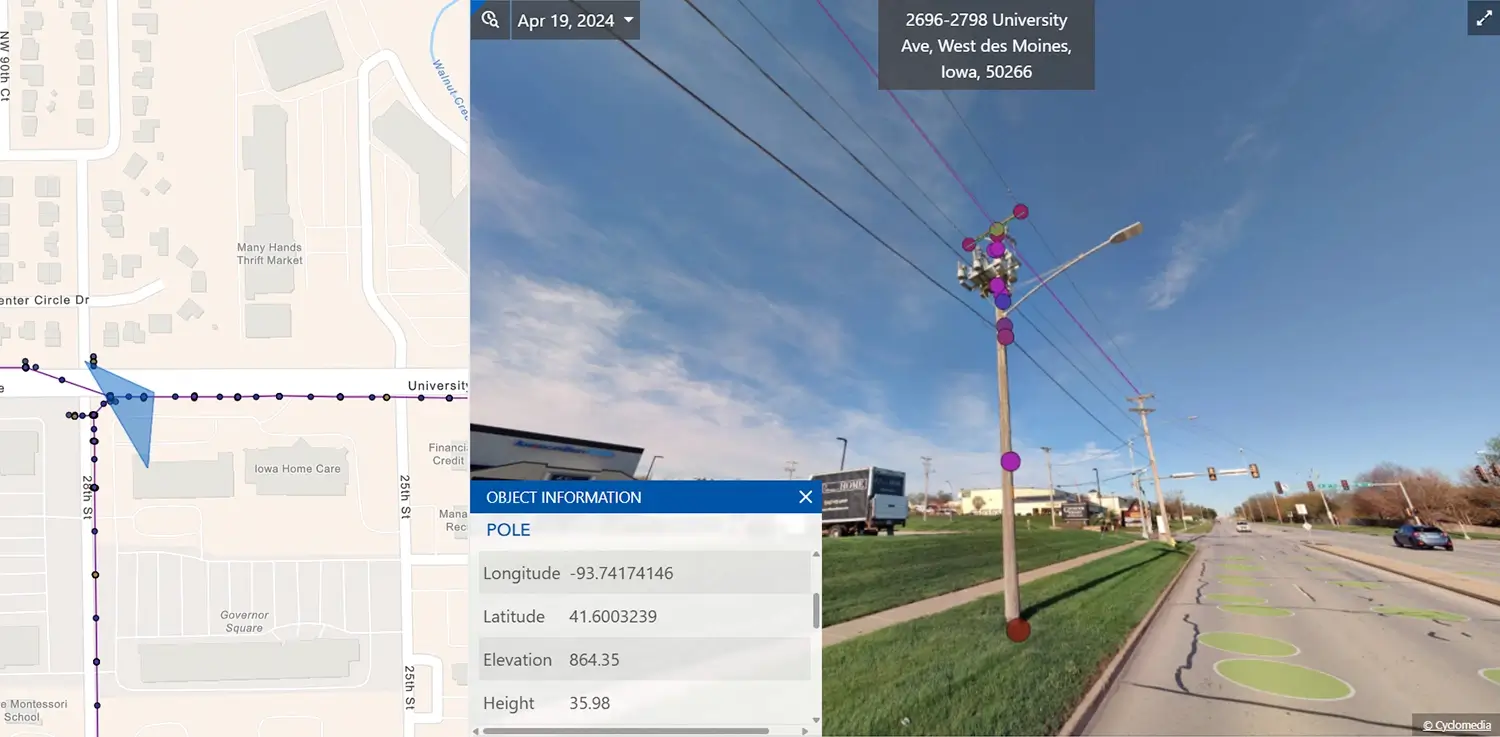
LiDAR data
Use 3D point clouds to measure assets, assess surroundings, and add spatial accuracy.
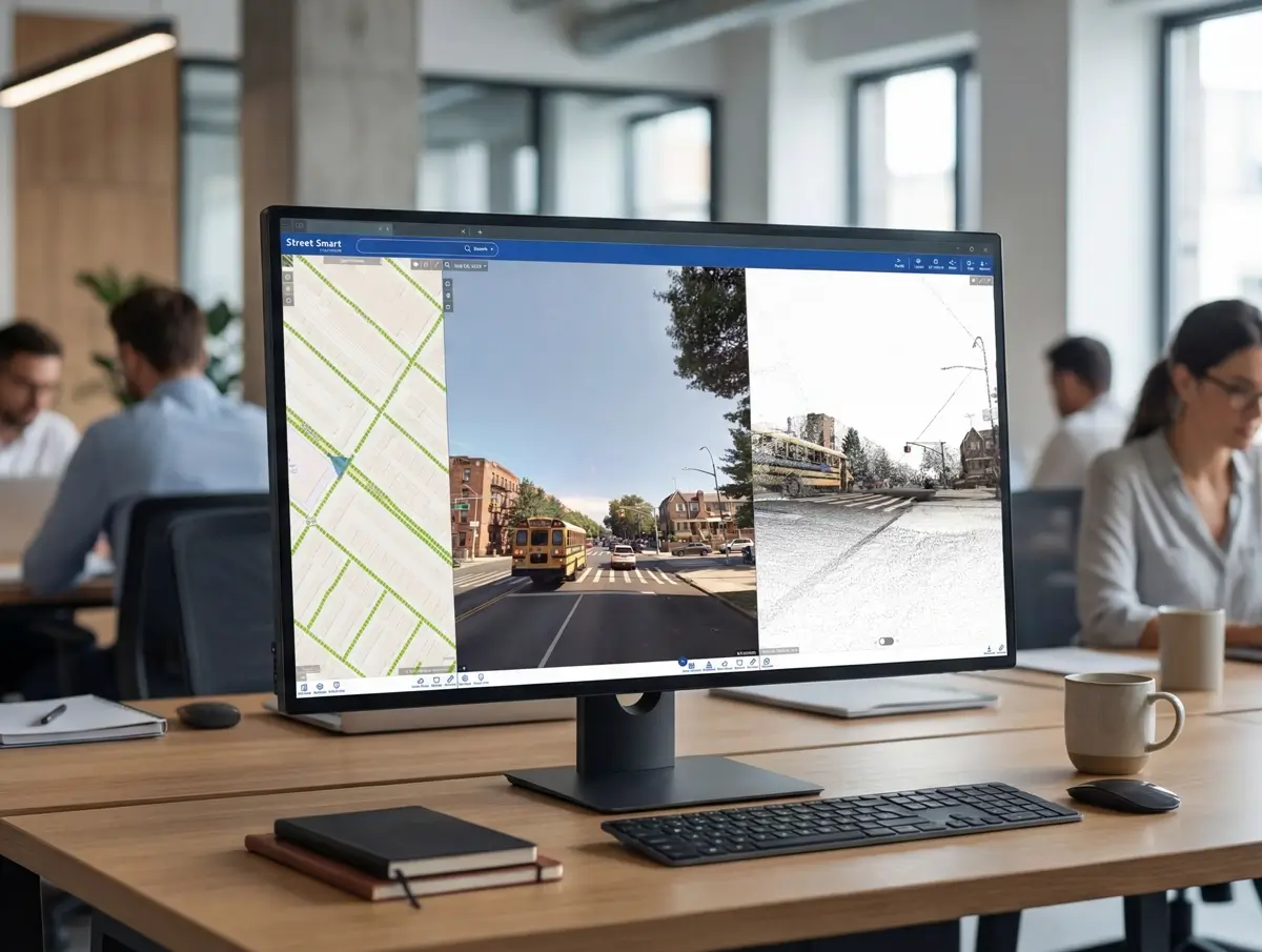
Street Smart platform
Central platform for viewing imagery, validating assets, and sharing insights across teams.
Asset data extraction
Automatically extract structured asset information from imagery to support inventories.
Change detection
Identify differences between capture cycles to support monitoring and updates.
GIS integrations
Integrate imagery and asset data directly into existing GIS workflows.
Measurement tools
Measure distances, heights, and clearances directly within the visual environment.
Digital twin infrastructure
Support planning and analysis using realistic, data-driven 3D representations.
Infrastructure intelligence
Combine visual and spatial data to support informed, defensible asset decisions.