Heading 1
Heading 2
Heading 3
Heading 4
Heading 5
Heading 6
Lorem ipsum dolor sit amet, consectetur adipiscing elit, sed do eiusmod tempor incididunt ut labore et dolore magna aliqua. Ut enim ad minim veniam, quis nostrud exercitation ullamco laboris nisi ut aliquip ex ea commodo consequat. Duis aute irure dolor in reprehenderit in voluptate velit esse cillum dolore eu fugiat nulla pariatur.
Block quote
Ordered list
- Item 1
- Item 2
- Item 3
Unordered list
- Item A
- Item B
- Item C
Bold text
Emphasis
Superscript
Subscript
Faster workflows, better decisions, and a realistic understanding of every location


Cyclomedia is a global leader in geospatial technology, transforming how organizations capture, visualize, and analyze the built environment.
With decades of innovation in street level imagery, LiDAR data capture, and AI powered analytics, we empower governments, businesses, and infrastructure professionals to make smarter, data driven decisions.
Our comprehensive platform combines cutting edge capture technology, cloud based visualization tools, and advanced machine learning to deliver unprecedented insights into urban infrastructure, enabling more efficient asset management, planning, and operations across diverse industries worldwide.

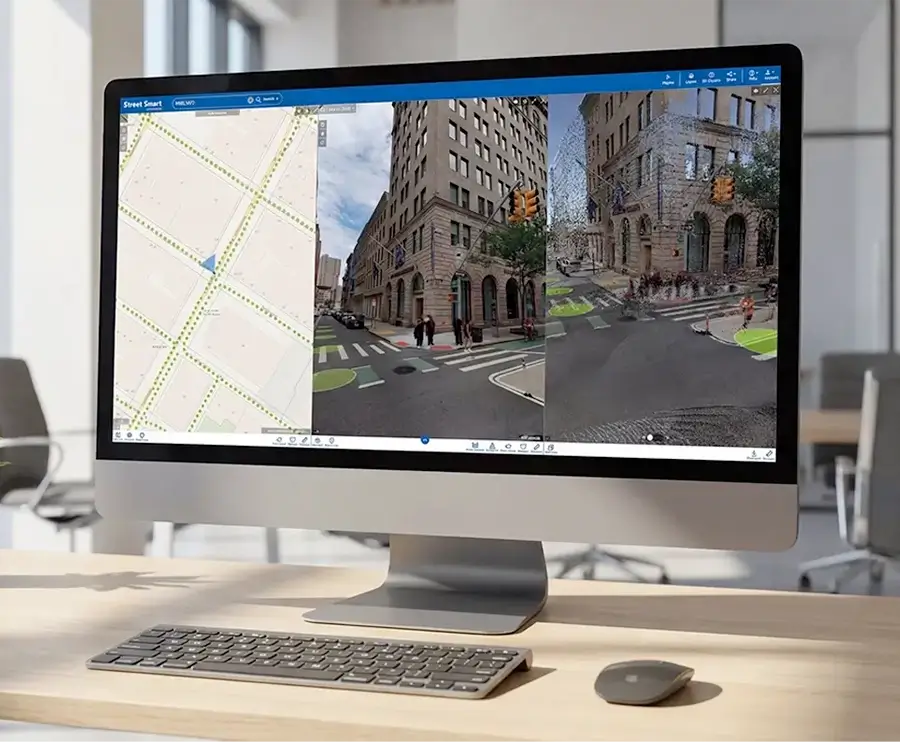
Cyclorama: High accuracy 360 degree street level imagery for inspection and measurement
Cycloramas capture the public space in high resolution, geometrically precise 360 degree imagery. Combined with accurate positioning and depth information, they enable professionals to inspect locations remotely, take reliable measurements, and document real world conditions without repeated site visits.
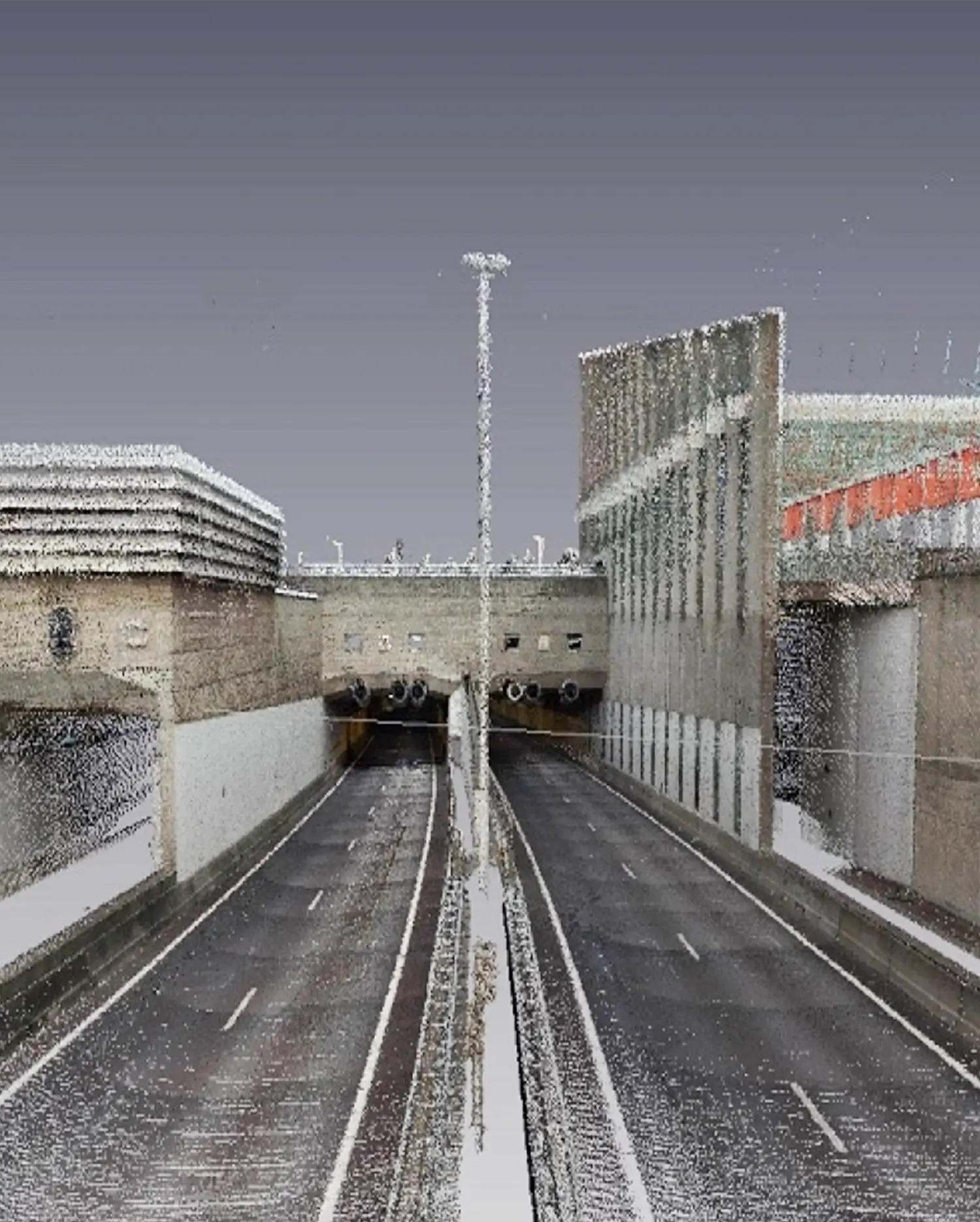
LiDAR: Precise three dimensional point cloud data for reliable spatial analysis
Cyclomedia LiDAR data delivers dense, accurately georeferenced point clouds that represent terrain, objects, and structures in three dimensions. This data supports reliable height, clearance, and volume analysis and integrates seamlessly with GIS and engineering workflows.
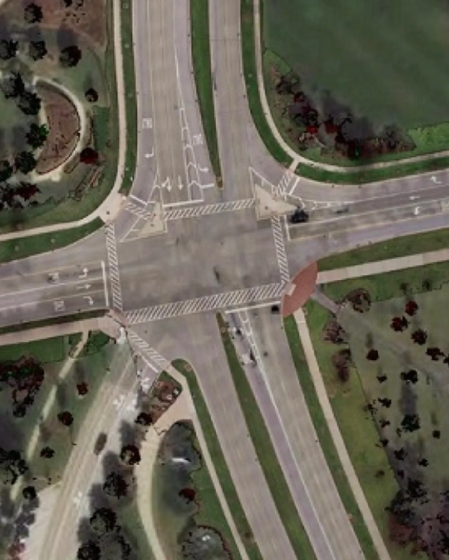
Street Ortho: Surface‑accurate orthographic street data for road and asset analysis
Street Ortho combines street level imagery with precise georeferencing to create distortion free, map aligned views of the road surface. This makes it possible to accurately assess surface types, road condition, markings, and assets directly in a GIS environment, supporting consistent analysis across large areas.
Aerial imagery: Nation wide nadir and oblique views for large scale context and planning
Cyclomedia aerial imagery combines high resolution nadir and oblique views to deliver complete visual coverage of urban and regional areas. This supports planning, asset overview, land use analysis, and validation of large scale developments with consistent, up to date imagery.

Find out where we have captured data. Zoom in and explore.