Turn real‑world data into clear, actionable asset data
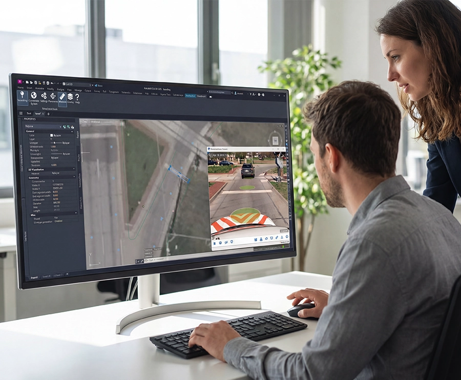
Cyclomedia Assets transforms imagery, LiDAR, and geospatial context into highly accurate, interpretable asset intelligence. Teams gain clarity, reduce manual work, and make confident decisions at scale.

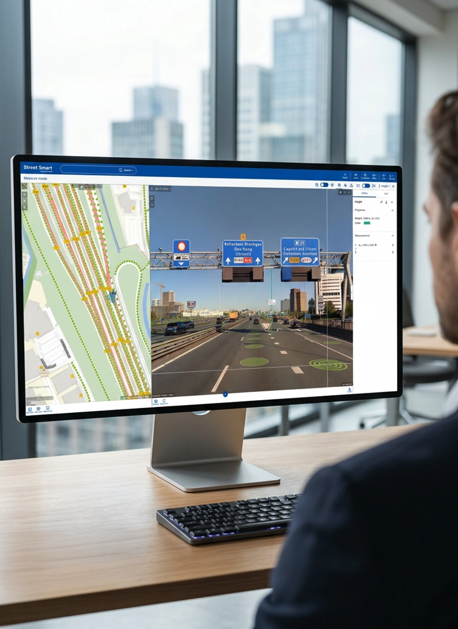


Cities, utilities, and infrastructure teams depend on accurate asset information. Field surveys and manual analysis slow progress and introduce inconsistency. Cyclomedia Assets provides interpretable analytics so teams can understand conditions, prioritise work, and act decisively.
95%
detection completeness
15 cm
positional accuracy
50+
asset categories
Actionable intelligence for planning, maintenance, and oversight
Cyclomedia Assets delivers analytical clarity across assets, conditions, and locations. It helps teams understand context quickly, prioritise work, and support decisions with consistent and interpretable information.
By leveraging AI-powered insights instead of manual surveys, you can:
Make faster, data-driven decisions
Turn reliable asset insights into confident, timely decisions that accelerate planning and improve operational performance.
Operational visibility
See conditions and context across networks to support planning and prioritisation.
Reduce inspection and field costs
Replace costly field surveys with AI-powered asset insights and reduce operational expenses without sacrificing accuracy and free teams to focus on decisions.
Detect changes and manage risk
Stay ahead of deterioration and unexpected issues with automated change detection and actionable insights.
Scalable asset delivery
Apply consistent, AI-driven assessment standards across your entire asset network, eliminating subjectivity and variation.
Support planning, maintenance, and operational decisions with clarity
Cyclomedia Assets provides interpretable analytics that help teams understand conditions, track change, and identify issues early. It strengthens planning, improves communication, and supports strategic and operational decisions.

Asset interpretation:
Understand key features and attributes across large networks without manual review.
Condition understanding:
AI-powered pavement inspection and condition assessment at scale.
Change awareness:
Identify relevant differences between time periods for operational decisions.
Planning support:
Use interpretable information to prioritise work and allocate resources.
Optimize maintenance planning:
Allocate budgets smarter by targeting maintenance where it delivers the greatest impact.
Organizations managing assets in the public right of way must rely on consistent and reliable intelligence
Intelligent right-of-way asset management
By integrating imagery, LiDAR, and intelligent automation, Cyclomedia delivers structured datasets across the assets that matter most. Our full DI portfolio is organized into themed product families designed around current-day focus areas for organizations managing asserts in the Right of Way. With built-in Asset Condition indicators and Change Detection capabilities, these families enable scalable oversight and long-term performance management.
Cyclomedia's Asset product families: Road Safety, Pedestrian Safety, Pavement and Surface, Traffic Control, Infrastructure, Utilities and Telecommunications, Tax and Property
Road safety - Pedestrian safety
Road Safety: Make roads safer with the right asset information to prioritize interventions, justify investments, and support evidence-based policy decisions.
Pedestrian Safety: Cities must protect pedestrians in increasingly busy and complex traffic environments. Support safer crossings, accessibility compliance, and inclusive mobility with objective insight into pedestrian infrastructure.


Pavement and surface - Infrastructure - Traffic control
Pavement and surface: Deteriorating roads require proactive management. Assess pavement condition to prioritize maintenance and rehabilitation based on objective insight.
Traffic control: Managing complex traffic environments requires accurate asset oversight. Track control infrastructure to enhance visibility, separation, and safer vehicle movement.
Infrastructure: Critical infrastructure must remain reliable under growing pressure. Gain objective insight into roadside, underground, and overhead assets to strengthen resilience and operational control.
Utilities and telecommunications - Tax and property
Utilities and telecommunications: Utility and telecom networks in the Right of Way demand precise asset visibility and reliable spatial accuracy. Leverage consistent spatial data to reduce field uncertainty, streamline planning, and strengthen operational reliability.
Tax and property: Use objective asset intelligence to support accurate taxation, defensible assessments, and improved compliance.