Heading 1
Heading 2
Heading 3
Heading 4
Heading 5
Heading 6
Lorem ipsum dolor sit amet, consectetur adipiscing elit, sed do eiusmod tempor incididunt ut labore et dolore magna aliqua. Ut enim ad minim veniam, quis nostrud exercitation ullamco laboris nisi ut aliquip ex ea commodo consequat. Duis aute irure dolor in reprehenderit in voluptate velit esse cillum dolore eu fugiat nulla pariatur.
Block quote
Ordered list
- Item 1
- Item 2
- Item 3
Unordered list
- Item A
- Item B
- Item C
Bold text
Emphasis
Superscript
Subscript
Complete and accurate 360 degree street level imagery of the built environment
Public organisations are responsible for understanding and managing streets, buildings, and public assets in detail. From inspections and maintenance to compliance and safety, decisions rely on having a clear and accurate view of real world conditions at street level.

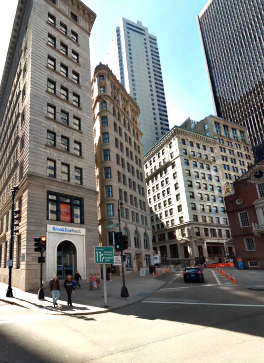
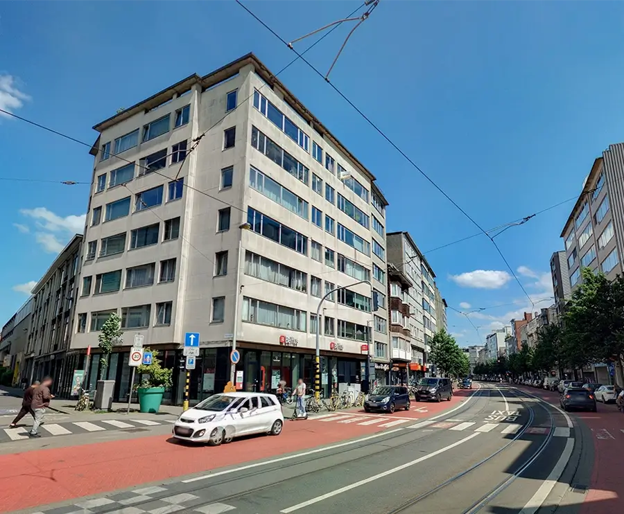
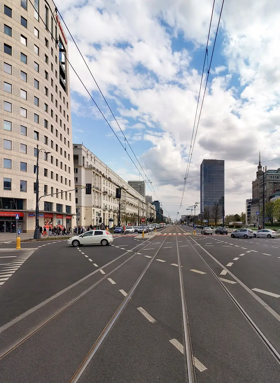
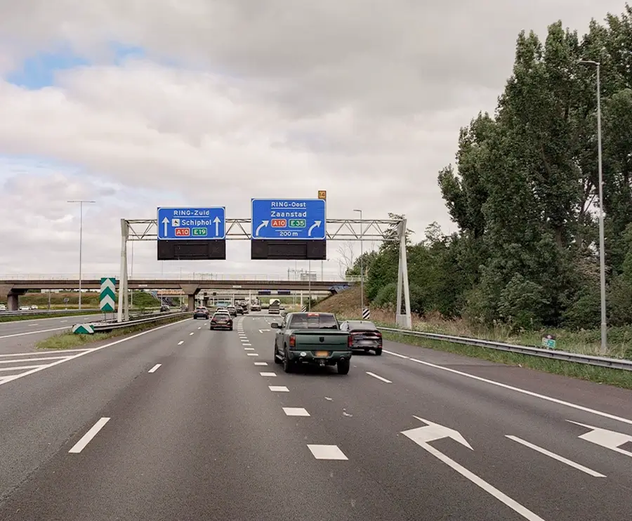
High resolution 360° panoramic representation of public space
With decades of innovation in street level imagery and LiDAR data capture, Cyclomedia provides a reliable digital representation of public space. Cycloramas form the visual foundation of this approach by capturing the street environment in high resolution, 360 degree panoramic imagery.
By delivering consistent and geometrically accurate images, Cycloramas enable professionals to inspect, measure, and understand street level conditions remotely. Combined with other geospatial data, they create a trusted basis for operational and planning decisions.
The high quality and resolution provide the clarity to see details like house numbers, infrastructure characteristics and the condition of assets and real estate. All can be viewed, assessed and analysed without having to go to the actual location.
By using complete street level visibility, companies and governments can make more informed decisions, improve operational efficiency, and provide faster, more transparent services.
Cycloramas provide a comprehensive and accurate visual record of the street environment. They help organisations reduce field work, validate assets remotely, and understand how conditions change over time using one consistent data source.
Deliver a complete 360 degree visual record of the street
Cycloramas capture the full surroundings at street level, providing a complete and immersive view of roads, buildings, and public space. This allows teams to understand context and detail without being on site.
Enable professional inspection and measurement
High geometric accuracy makes Cycloramas suitable for professional use. Teams can perform reliable measurements and inspections directly from their desktop, supporting engineering, maintenance, and compliance workflows.
Allow remote validation of assets and conditions
Assets, buildings, and public space conditions can be validated remotely using Cycloramas. This improves efficiency and reduces the need for repeated site visits across departments.
Support historical comparison and change tracking
Cycloramas make it possible to compare different moments in time. This supports change detection, condition monitoring, and validation of when and how the environment has evolved.
Reduce dependency on on site inspections
By providing a reliable and up to date street level view, Cycloramas limit field work to cases where physical presence is truly required. This saves time, lowers operational costs, and reduces disruption.
360 degree panoramic imagery
You can switch between the Cyclorama and LiDAR view